I tested for you: the Schneeberg circuit

Our experience at the Schneeberg
Step 1: Start of the hike to the Schneeberg
Monday morning, departure from the tourist office in Wangenbourg-Engenthal, we are at the parking lot of the Fifth Army. Wearing our best pair of hiking boots and our map picked up at the tourist office, we are ready for what awaits us. With the sunglasses firmly on your nose, you head for the day’s objective: to reach the summit of the Schneeberg, which rises to 961 metres. Departure at 11am under a bright sun, we set off to follow the road of General de Gaulle directly to the left as we leave the car park.
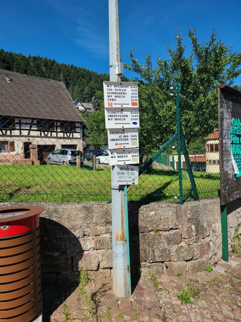
Once in front of the Proxi, we reach the street of the panorama, located directly to its right. A first sign indicates the summit of the Schneeberg at about 1h35 via the GR53 (recognizable by its red rectangle). We now know that by following this marking, it will be very easy to find our way around. Taking the panorama route, we pass in front of the first viewpoint that rises before our eyes. Without knowing it, we meet a hiker whom we will meet later at the top of the Schneeberg. Let’s go! We climb the stairs before arriving at the foot of the forest, where the hiking trail begins. We don’t take the panorama route but the one higher up, which will take us to the Schneeberg. 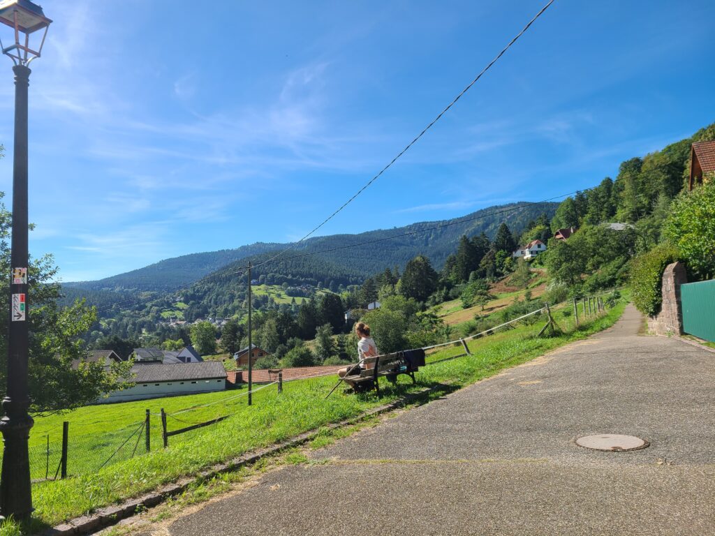
Stage 2: First part to the Schneeberg Pass via the GR53
The entire first part is very accessible. We follow wide dirt paths in the middle of the forest guided by the red rectangle of the GR53. A long false flat spreads out in front of us but remains pleasant for the heart that barely beats. We are surrounded by trees that give us a glimpse of the other side of the top of the massif. Already at this height, we are happy with what we are seeing. We pass in front of a very old anthill with an approximate height of 1 meter, which is impressive. The greenery envelops us through its trees and its lawn that rests on the paths connects us more to nature.
Don’t forget to drink plenty of water along the way because things get tough after that.
Stage 3: Head for the Col du Schneeberg via the Vosges club markings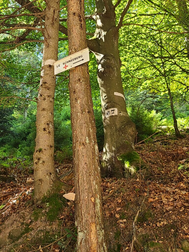
We finally leave the Nordic walking markings to branch off onto the hiking trail where we now follow the markings of the Vosges club. We are now ready to start the second stage, much more sporty but also very fun. The path is a little more strewn with pebbles or even a few rocks, which allows us to wedge our feet between each of them for this tough climb. The trail is not unpleasant or difficult, it is simply intense, perfect to fill the heart of any hiker.
 Stage 4: Ascent to the Schneeberg Pass
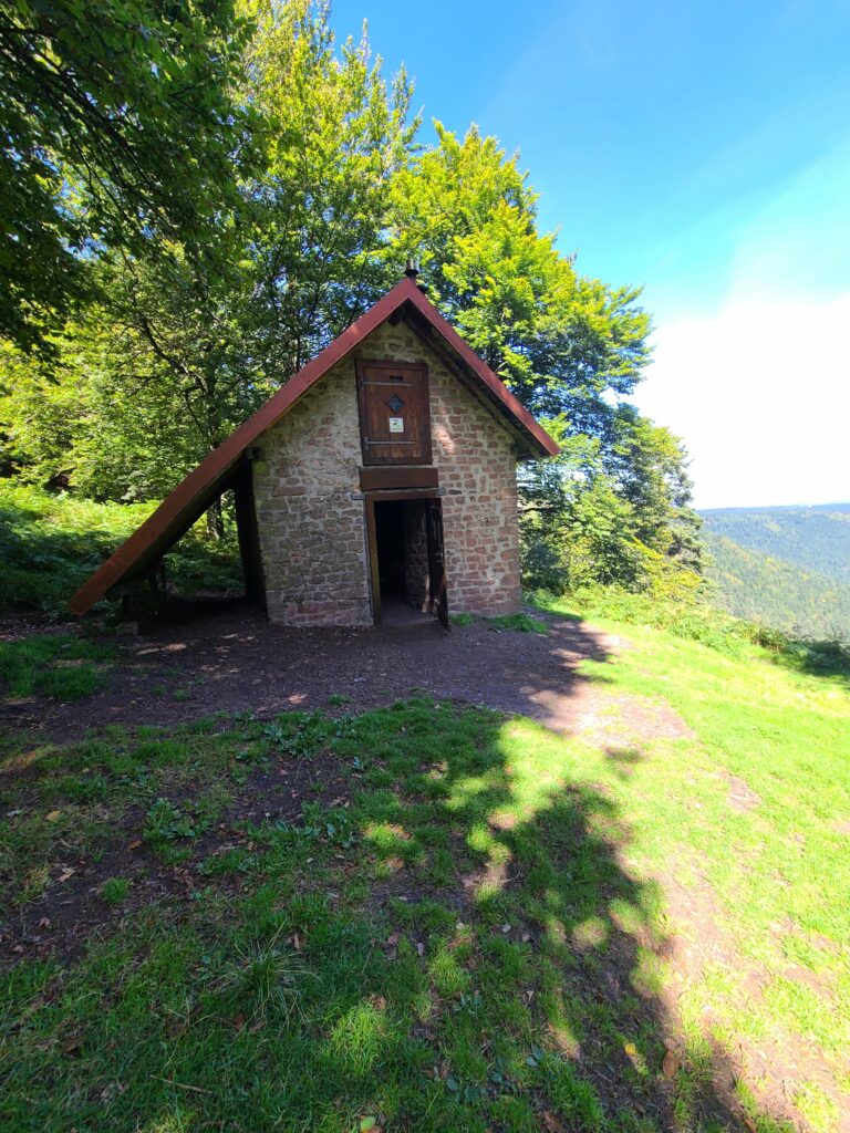
At the end of this ascent, guided by the red cross markings in honour of the Schneeberg circuit, we finally arrive in front of the Schneeberg hut, which welcomes us with a sumptuous view of Wangenbourg-Engenthal and its surroundings. From up there, we can even see Wangenburg Castle happily perched on its rock. It’s 12:45 p.m. when we get there. It’s time for us to immortalize this moment and revel in this landscape that is deliciously outlined before our eyes. What a great reward after this hike full of emotion.
We have already covered 1h45 of pure ascent so far with an average pace of 14.39/km.
Stage 5: Ascent to the Lottelfels rock
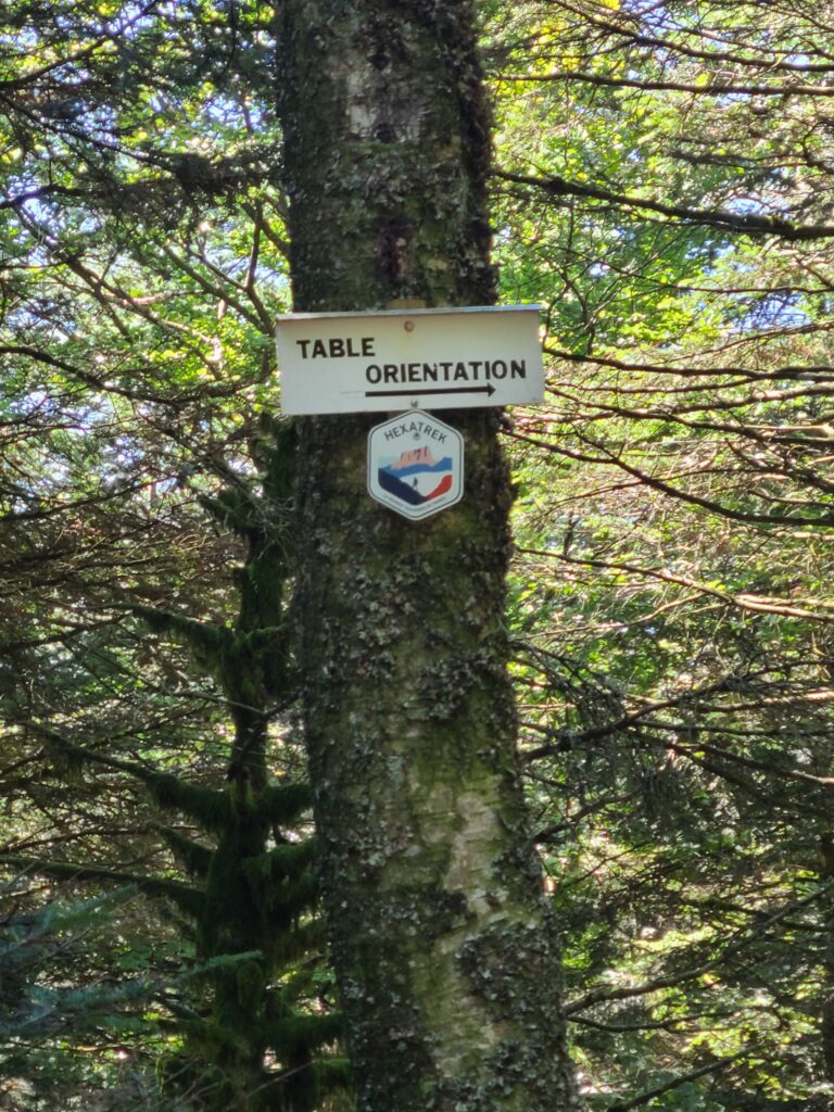 Determined to take in the sights again, we persevered, extending our path towards the Lottelfels rock. This time, the trail is narrower but bypasses this view that accompanies us from the Schneeberg. In a few strides, we arrive at this new destination via the spring. If it flows generously, you should take the opportunity to fill your water bottles! Last tag that tells us “The orientation table” and here we are. Soon, we arrive in front of these majestic steps that invite us to climb the immense rock. We are not alone as we meet other hikers, including even locals who are comfortably installed on the rock. Taking a deep breath of the many legends that resonate around this rock, we are at the highest point, savoring the end of this incredible ascent.
Stage 6: Descent and arrival
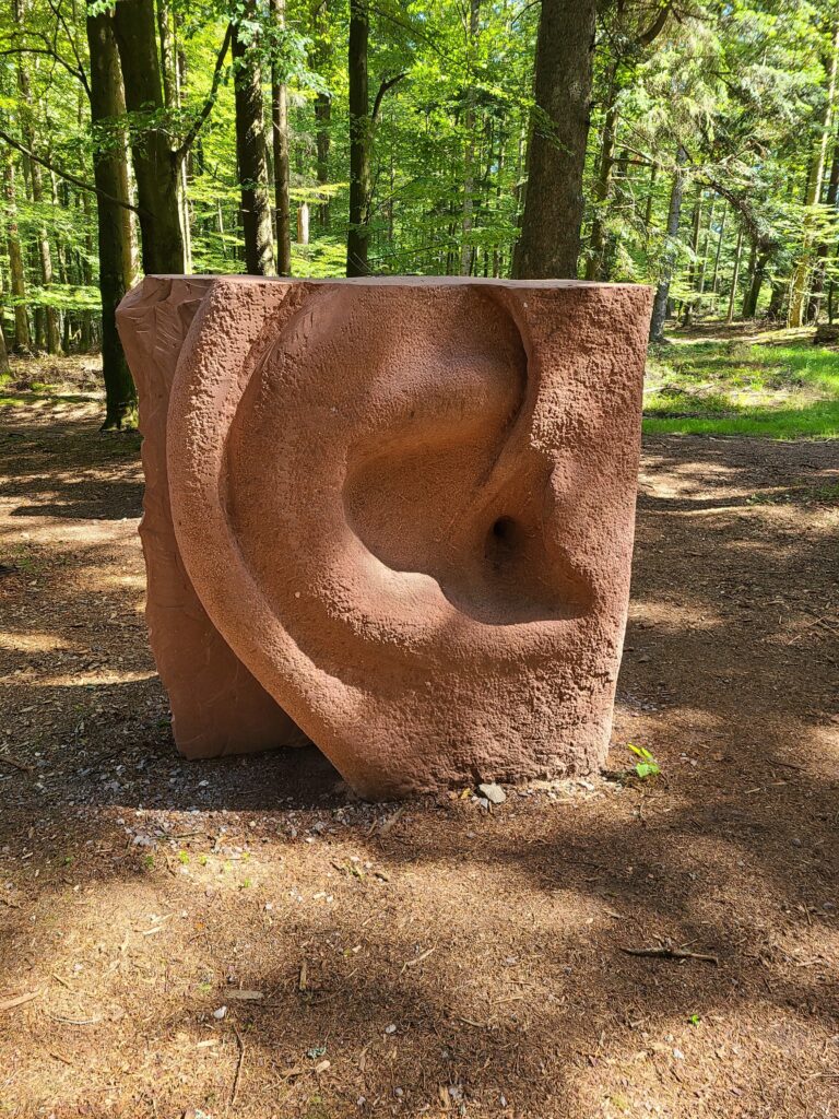 Once at the top, of course, you have to go back down. In reality, this is the easiest part because if going back down to the top of the Schneeberg is a little trickier because of its slightly narrower path, once back at the hut we simply turn around on the trail. The descent is over a difference in altitude of 532 meters since it is a question of going the other way. You might think that the latter is steep but not at all! Finally, as we take a small part of the sculpture symposium, we come across some of the new sculptures. Finally, we finish the hike back to the tourist office.
To conclude…
The Schneeberg circuit is as mythical as it is described. After covering a total elevation gain of 532 meters to reach a height of 961 meters, we have a good feeling. It took us between 2h30 and 3h for this hike of a little more than 10 km with a cruising pace.
What tips can you help you prepare for your hike to the Schneeberg?
We recommend that you equip yourself as you would for any other hiking outing and have your water bottle with you! Don’t forget to take something to immortalize this unforgettable moment when you reach the top of the Schneeberg because it’s worth the detour! For our part, we can’t wait to do it again!
